404 Rangers
Ashpond_system
"team your system couldn't find"
Submitted
May 22, 2026, 6:48 AM
Last Updated
May 22, 2026, 6:48 AM
Project Links
Problem Statement
Coal ash ponds at thermal power plants in India pose a severe environmental and public safety risk. When the earthen dykes retaining these ponds fail, they release toxic fly ash slurry that contaminates groundwater, destroys agricultural land, and causes loss of life. The Sasan UMPP breach in April 2020 is a documented example where no early warning system existed to predict or prevent the failure. Current monitoring is reactive — inspections are infrequent, manual, and unable to detect the gradual multi-factor deterioration that precedes a breach. No existing operational system integrates satellite remote sensing, hydrological forecasting, and machine learning to provide continuous, quantified risk scores across multiple sites simultaneously.
Solution & AI Usage
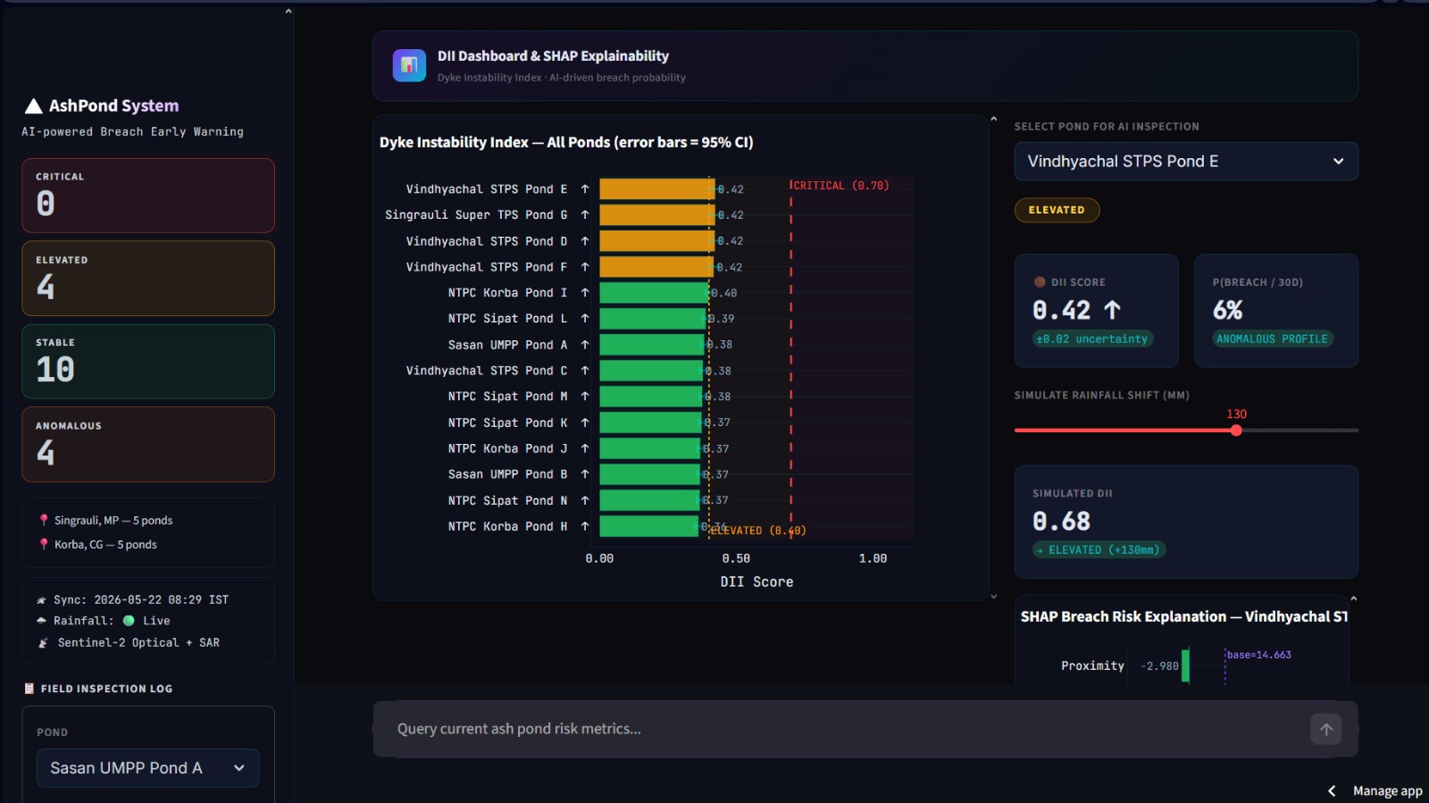
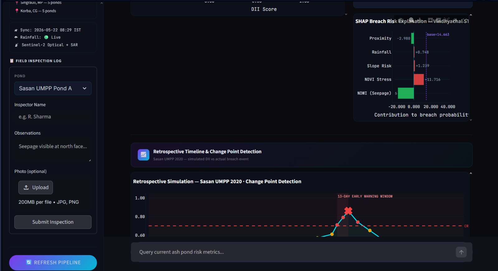
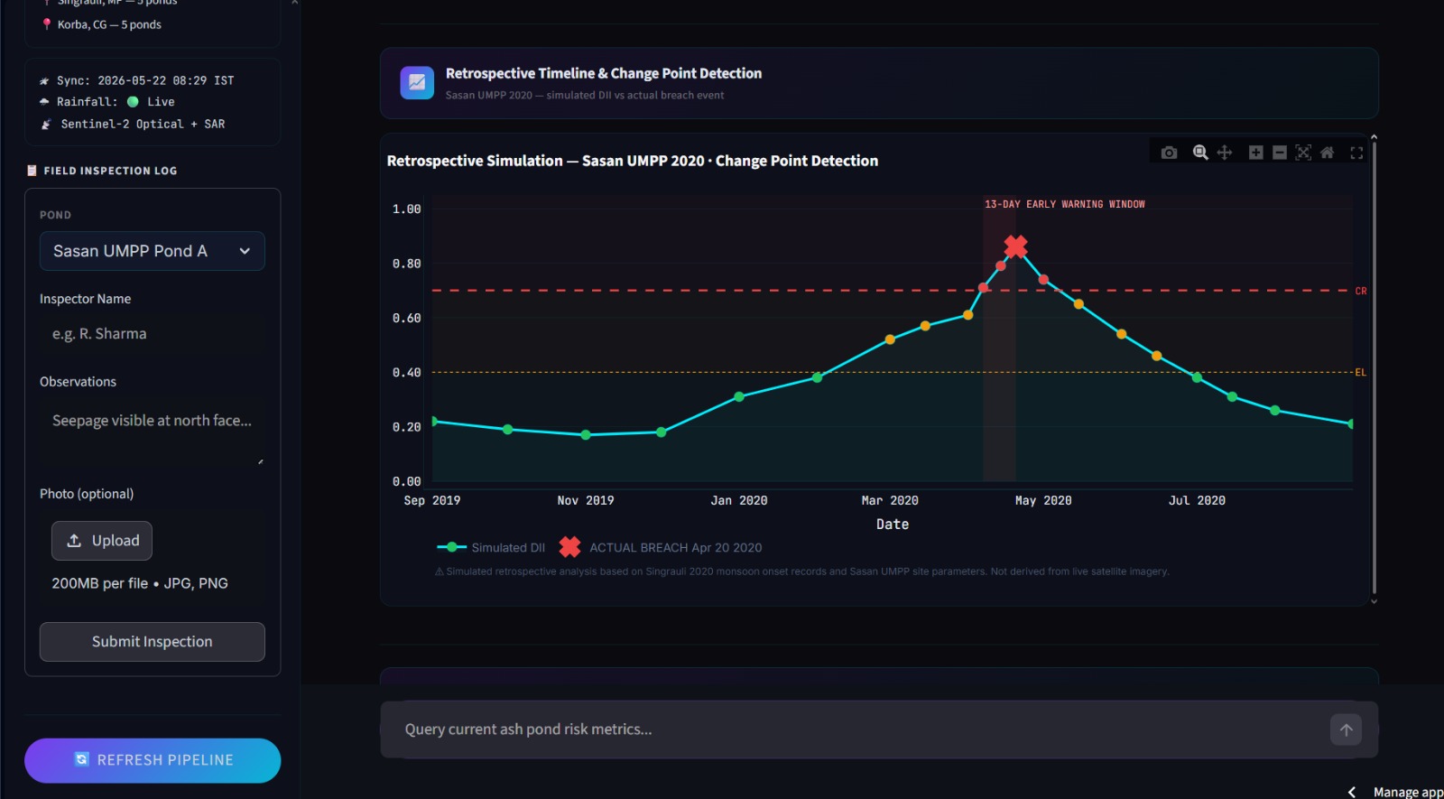
AshPond is an AI-powered breach early warning system monitoring 10 coal ash ponds across Singrauli (MP) and Korba (CG). Sentinel-2 satellite imagery computes NDWI for seepage detection and NDVI for vegetation stress. Sentinel-1 SAR captures dyke surface backscatter. Open-Meteo delivers live 72-hour rainfall forecasts. These five signals feed a weighted Dyke Instability Index (DII), scoring each pond 0–1 and classifying it as STABLE, ELEVATED, or CRITICAL. A Cox Proportional Hazards model — trained on 48 real breach and near-miss events with Gaussian augmentation — outputs a 30-day breach probability per pond. Bayesian Monte Carlo sampling (1000 iterations) produces 95% confidence bounds on every DII score. Mahalanobis distance detects anomalous sensor profiles deviating from safe historical baselines. SHAP KernelExplainer surfaces the dominant risk driver at each site, making every prediction auditable. Ruptures PELT change point detection, validated against the 2020 Sasan UMPP breach.
Full Description
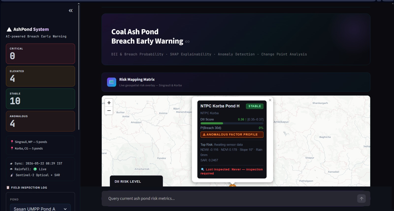
AshPond Early Warning System is an AI-powered continuous monitoring platform designed to predict coal ash pond dyke failures before they occur. Coal ash ponds at thermal power plants retain millions of tonnes of toxic fly ash slurry behind earthen embankments. When these dykes fail, the consequences are catastrophic — groundwater contamination, agricultural destruction, and loss of life. The April 2020 Sasan UMPP breach in Singrauli is a documented case where no predictive system existed. AshPond is built to prevent the next one. The system monitors coal ash ponds across three high-density thermal clusters — Singrauli, Madhya Pradesh (Sasan UMPP, Vindhyachal STPS, Singrauli Super TPS, Rihand STPS), Korba, Chhattisgarh (NTPC Korba, CSEB Korba East, CSEB Korba West), and Bilaspur, Chhattisgarh (NTPC Sipat). Ponds are not manually catalogued — they are automatically detected. A satellite pond detection module queries Sentinel-2 imagery via Microsoft Planetary Computer, computes NDWI grids across each plant's search radius, applies threshold masking, runs scipy connected component labeling, filters components by area (5–500 hectares), extracts centroid coordinates via UTM-to-WGS84 projection, and deduplicates overlapping detections. This produces the live pond inventory without manual input. Each detected pond is assigned a Dyke Instability Index (DII) scored 0–1, classified as STABLE, ELEVATED, or CRITICAL, with a trend arrow (↑↓→) tracking movement between refresh cycles. The DII fuses five signals: Sentinel-2 NDWI for surface seepage detection, Sentinel-2 NDVI for embankment vegetation stress, Sentinel-1 SAR backscatter for subsurface moisture, Open-Meteo 72-hour batched rainfall forecasts, and historical breach proximity scores encoding site-specific structural vulnerability. Each signal is normalised and combined via calibrated weights summing to 1.0. A dominant top_risk_factor is identified per pond and surfaced on the map and dashboard. A Cox Proportional Hazards survival model — trained on 48 documented breach and near-miss events across Indian thermal plants, augmented 20x via Gaussian noise injection — converts the feature vector into a 30-day breach probability. Bayesian Monte Carlo sampling runs 1000 perturbation iterations per pond to produce 95% confidence intervals on every DII score, quantifying sensor uncertainty explicitly. Mahalanobis distance detects ponds whose sensor profiles deviate statistically from the safe historical baseline, flagging dangerous anomalous combinations that individual metrics may miss. SHAP KernelExplainer decomposes each breach probability into per-feature contributions, making predictions fully auditable. Retrospective validation reconstructs the 2020 Sasan UMPP event. PELT change point detection applied to the historical DII timeseries identifies a structural behavioural shift on April 7 — 13 days before the April 20 breach — validating the system's early warning capability against a real failure.
Tech Stack
Screenshots
4 attached